Flying Sites
|
CONTEST FLYING SITE The club is currently looking for a primary flying site. |
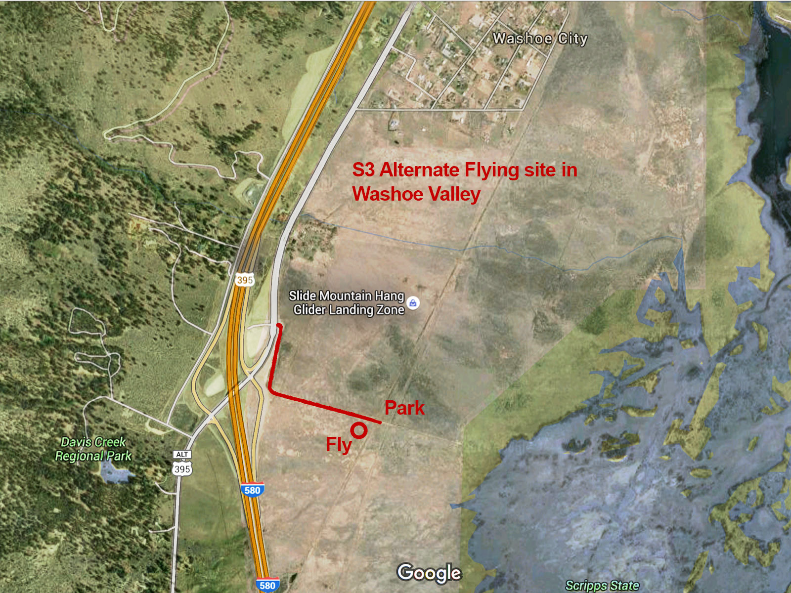 |
ALTERNATE WASHOE VALLEY SITE This flying site is open to the public and can be used at any time. The area is north of Bowers Mansion, just East of old 395 and just South of the area that Hang Gliders use as a landing zone. The dirt access road is off of old (Alt) 395. The area is fenced and can't be driven onto, but an open gate is close to the parking area. |
 |
BELLEVUE ROAD IN WASHOE VALLEY
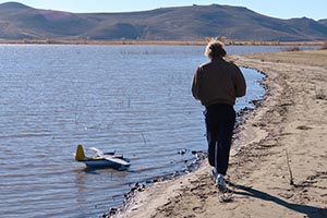
This site is public use and is located on the West side of the South end of Washoe Lake, at the Bellevue Road exit (where there's an overpass that goes over 395). There is enough room to set up a winch and to fly small electric planes, and is also a good place to fly float planes. S3 members use this site as a fun-fly area. Be mindful of others sharing the space (dog owners, jet-skiers, etc.). |
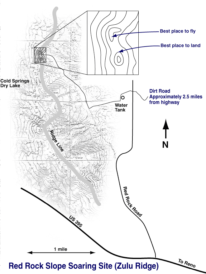 |
RED ROCK SLOPE SOARING SITE The Premiere Slope Site for the Reno Area. Flying at Red Rock- The ridge faces nearly due west with a very large dropoff (approx. 500 ft). You can walk down to retrieve a plane. When the wind blows you can't keep airplanes down. The air is smooth. You can fly combat very close to you, or explore over 1 mile from you. There is lift all along the ridge to the left. The ridge extends about 2 miles north-south. Planes are visible easily. Care must be taken not to get into the downdrafts in back of the hill when landing. Landing is to the left toward a small hill nearby. Landing in the saddle is best, but keep the nose down, it is a long walk through the sagebrush to get a plane which lands downwind. We have not tried Dynamic Soaring here but the best spot may be just over the parked cars and asembly area. Take care. For current wind and weather conditions in North Reno click here |
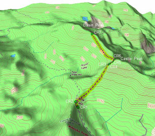 |
CASTLE PEAK SLOPING
This site is located at Donner Summit on I80 about 40 miles west of Reno. High elevation and stunning views. Click here for more info about Castle Peak sloping. |
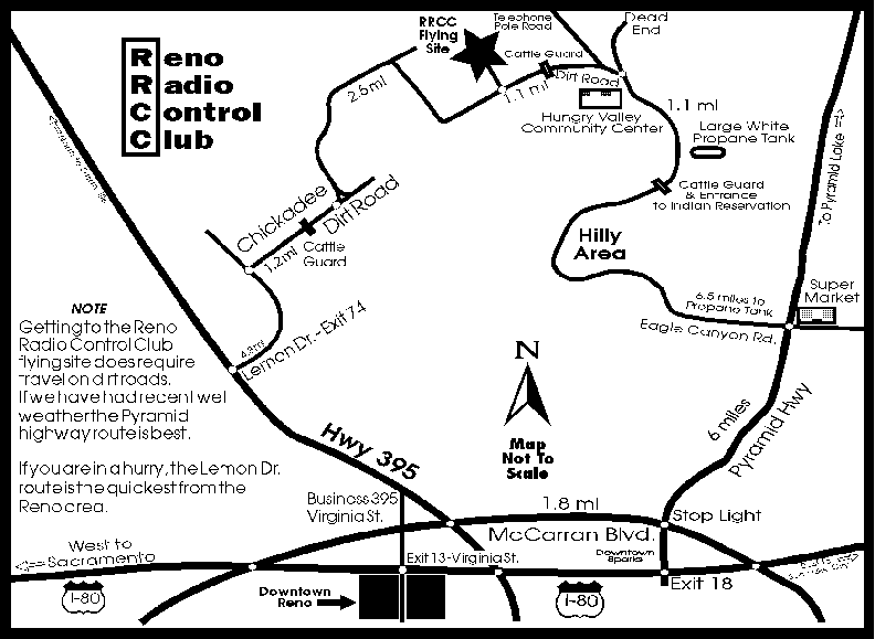 |
INTERNAL COMBUSTION POWERED PLANES The Reno Radio Control Power club has a field north of Reno. It is easily accessible from either HWY 395, or from the Pyramid Lake highway. I have added a map to this site as a courtesy. An AMA license is required to fly at the field. |
The High Sierra RC Club in Carson City has an official City Park flying site east of Carson City on Hwy 50. It obtained with the help of the AMA. Many powered RC and free flight events are held there each year.
Directions: From Carson City take Hwy 50 east. As you leave Carson City Hwy 50 goes uphill. As you go uphill, pay careful attention to the sign on your right indicating the turn off to the Carson City Dump. Take this road south of Hwy 50 less than 1/4 mile, and as the road turns west there is a dirt road going east. Take this dirt road directly to the flying field. You can see the field at the bend.